01
Meeting at Murshidabad Municipality on Dengue & Aswaas Portal
01
Advertisement for "Shop at Old Chilling Plant" on rent
ডেঙ্গু সতর্কতা
ডেঙ্গু সতর্কতা
01
ডেঙ্গু সতর্কতা
ডেঙ্গু সতর্কতা
ডেঙ্গু সতর্কতা
02
ডেঙ্গু সতর্কতা
01
Swachhta Hi Seva
02
Swachhta Hi Seva
03
Swachhta Hi Seva
04
Swachhta Hi Seva
05
Swachhta Hi Seva
2 Nd MAA Canteen
2nd MAA Canteen (Ward No. 03, Old Chilling Plant, P.O.- Barua, P.S.- Beldanga, Dist.- Murshidabad, Pin- 742189)
1
2 Nd MAA Canteen
1st MAA Canteen
1st MAA Canteen (Ward No. 04, "SAMPARKA Hall", P.O.-, P.S.- Beldanga, Dist.- Murshidabad, Pin- 742133)
2
1st MAA Canteen
Electric Crematorium Inauguration
Electric Crematorium Inauguration
Electric Crematorium Inauguration
School Uniform Tailoring by SHGs.
School Uniform Tailoring by SHGs.
01
School Uniform Tailoring by SHGs.
Selfie with Tree Event
Selfie with Tree Event
Selfie with Tree Event
Financial literacy camp at ward no 2 on 30.7.2021
Financial literacy camp at ward no 2 on 30.7.2021
Financial literacy camp at ward no 2 on 30.7.2021
বনমহোৎসব
পালন 2021
বনমহোৎসব পালন 2021
1
বনমহোৎসব পালন 2021
বনমহোৎসব
পালন 2021
বনমহোৎসব পালন 2021
2
বনমহোৎসব পালন 2021
বনমহোৎসব
পালন 2021
বনমহোৎসব পালন 2021
3
বনমহোৎসব পালন 2021
বনমহোৎসব পালন 2021
3
বনমহোৎসব পালন 2021
বনমহোৎসব পালন 2021
বনমহোৎসব পালন 2021
4
বনমহোৎসব পালন 2021
Oath Taking
Ceremony
Oath Taking
Ceremony
Ceremony
1
Oath Taking
Ceremony
Ceremony
Oath Taking
Ceremony
Oath Taking
Ceremony
Ceremony
2
Oath Taking
Ceremony
Ceremony
Blood
Donation
Camp
Blood Donation Camp.
1
Blood Donation Camp.
Blood
Donation
Camp
Blood Donation Camp.
2
Blood
Donation
Camp
Donation
Camp
E-Bela
Android Mobile
Application
24/7 at your Service
E-Bela
Rally on 29.11.2022
1
Rally on 29.11.2022
Rally on 29.11.2022
2
Rally on 29.11.2022
Rally on 29.11.2022
Rally on 29.11.2022
3
Rally on 29.11.2022
100% LED
SMART
LIGHTING
GPS location based switching of streetlights.-Automatic On/Off based on Sunrise/Sunset or on programmed timings-
100 % LED
Smart Lighting System
Smart Lighting System
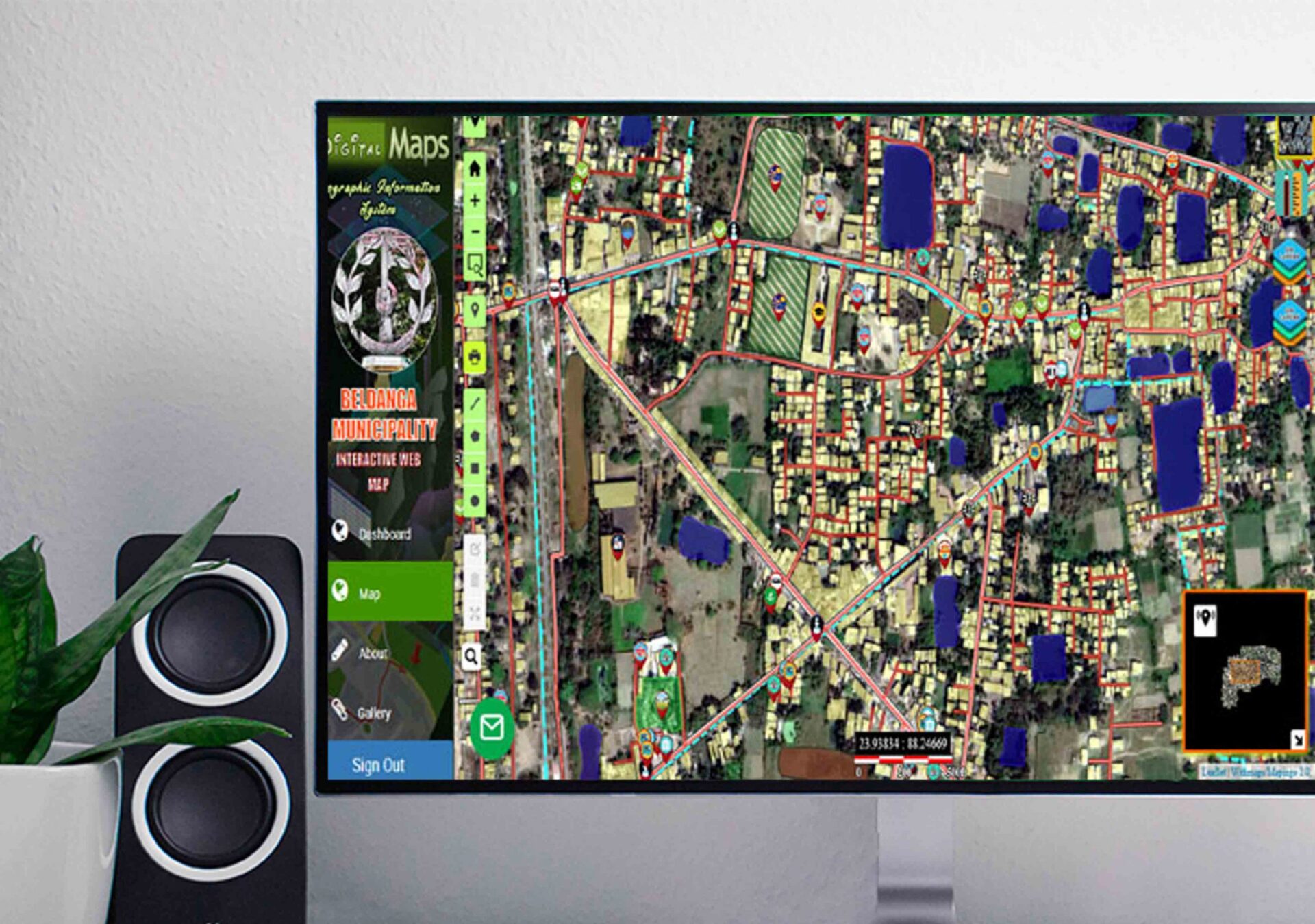
SMART MAP
GIS based Fully Interactive Web Map.
Fully Interactive Web Map
CCTV Camera
System
BELDANGA MUNICIPAL Expands CCTV Camera System, Effective Resource Proven Instrumental in Apprehending Suspects and Closing Court Cases
CCTV
Trauma Care
Ambulance
Services
24/7 at your Service
trauma care ambulance
About Us


-
Beldanga is a small municipality of Murshidabad district, situated in the eastern part of river “Bhagirathi”.Beldanga started to be urbanized during the 1960’s till its population grew to the size of a municipality during 1970’s. Finally the municipality was established on 28th November 1981 with the notification number 928, C‐4, M.I.M‐36/79 dated 19/11/1979. Before it was declared as a notified area, it was a gram panchayat, namely Beldanga, a part of Debkundu. It was formed after taking 3.98 Sq..Kilometer from Debkundu Gram Panchayat. .At the beginning it was divided into 17 wards but later they were merged into 14 wards. According to the Beldanga Mouza Map, the entire area
includes the following areas: J.L. No‐51, same parts of Sarulia
Mouza J.L. No‐59 and same parts of BaruaMouza J.L. No.‐60.
Location and Communication:- The Beldanga Municipal town is situated under Beldanga Block-1 in the Berhampore Sub-Division of the District Mushidabad . It is a town situated very near to the border of Bangladesh on its East-Side and with river Bhagirathi on its West-side. It is an old town and was constituted as a Municipality in 1981. Berhampore is the District Head Quarter and its distance from Head Quarter is 20 km. The town is 180 Km. away from Calcutta. The town has well-connected transport facilities having Board Gauge Railway connection by Sealdah-Lalgola section of Eastern Railway and Road connection through National Highway A12 (NH-34) with Calcutta and the District Head Quarter Berhampore town as well as Sub-divisional town, The Beldanga town are also well connected by State Highway namely BAP Road.
Area :-The town covers an area of 3.98 sq.km. Containing 14 wards, comprising Mouzas and housing 5260 holdings.
What are The Today Activities of ULB of Beldanga Municipality
Explore Online Services
PWD
Department
The Department of PWD is situated on the ground floor of the beldanga municipality
Disaster
Management
In order to deal with all humanitarian aspects of crises, crisis relief means
Store
Department
The Department is now headed by the Charge Stores Officer who, by traditional sourcing and GeM, is
Light
Department
Dept of Lighting. Basically, we provide facilities for the installation and maintenance of street
Trade
License
The first password for joining the corporate environment is a commercial certificate.
The BM License


